


 English
"Falcon" intensified into a tropical storm as it moved west to Cagayan, the Philippine Atmospheric, Geophysical and Astronomical Services Administration (Pagasa) reported Tuesday afternoon.
In the weather bureau's sixth severe weather bulletin posted at 5 pm , Falcon became a tropical storm as of 2 pm.
Falcon was last seen at 335 kilometers east-southeast of Tuguegarao City, Cagayan. It has maximum winds of 65 kilometers per hour and gusts of up to 80 kilometers per hour.
Pagasa's data also showed Falcon moving west at 30 kilometers per hour.
Tropical Cyclone Warning Signal Number 2 was raised over northeastern portion of Cagayan, including Babuyan Group of Islands.
Tropical Cyclone Warning Signal Number 1 was raised over Batanes, rest of Cagayan, northern potion of Abra, Apayao, Kalinga, Isabela, eastern portion of Mt. Province, and eastern portion of Ifugao.
Pagasa said Tropical Cyclone Warning Signal Number 1 may be raised over northern portions of Aurora, Quirino, and Nueva Vizcaya and the rest of Abra, Mt. Province and Ifugao in the next few hours.
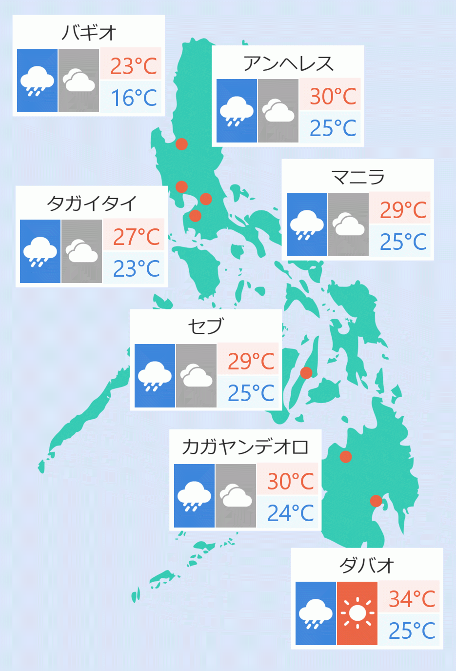
''Falcon'' will also bring light to heavy rains in different portions of the country.
"Between today and tomorrow afternoon, moderate to heavy rains will be experienced over all over Ilocos Region, Cordillera Administrative Region, Cagayan Valley, Nueva Ecija, Aurora, Zambales, Occidental Mindoro, northern Palawan including Calamian ad Cuyo Islands," Pagasa said.
Light to moderate rains will also fall over is also expected over Metro Manila, Calabarzon, Bicol Region, and the rest of Visayas and Central Luzon on Wednesday. the weather bureau added.
On Thursday, moderate to heavy rains may also prevail over Ilocos Region, Cordillera Administrative Region, and Cagayan Valley. Light to moderate with at times heavy rains is likewise expected over Metro Manila, Central Luzon, Calabarzon and Mimaroapa.
Residents in these areas are advised to take precautions.
Seacraft are advised not to venture out over the eastern seaboards of Central Luzon, Southern Luzon, and Visayas.
"This weather disturbance is expected to closely approach or make landfall over Babuyan-Batanes Islands area tomorrow evening and may exit the Philippine Area of Responsibility (PAR) on Friday," Pagasa said. Cristina Eloisa Baclig/DMS