


 English
Tropical storm warning signals were raised in some parts of the country as a low pressure area (LPA) developed into a tropical storm named "Jolina" on Monday.
As of 5pm, Tropical Storm ''Jolina'' was at the vicinity of 95 km east of Guiuan, Eastern Samar with maximum winds of up to 75 kph near the center, gusts of up to 90 kph and central pressure of 1000 hectopascals.
''Jolina'' was moving "westward northwestward" at the speed of 20kph.
The state weather bureau placed the areas of Eastern Samar, the eastern portion of Northern Samar (Palapag, Mapanas, Gamay, Lapinig, Laoang, Catubig, Las Navas, Pambujan), and the northeastern portion of Samar(Matuguinao) under signal number two.
The eastern portion of Camarines Sur (Calabanga, Bombon, Magarao, Canaman, Camaligan, Gainza, Naga City, Milaor, Pili, Minalabac, Bula, Balatan, Nabua, Bato, Iriga City, Buhi, Baao, Ocampo, Sagñay, Tigaon, Goa, Tinambac, Siruma, Lagonoy, San Jose, Garchitorena, Presentacion, Caramoan, San Fernando), Catanduanes, Albay, and Sorsogon are under signal number one.
Also placed under signal number one are Biliran, the eastern portion of Leyte (Babatngon, San Miguel, Barugo, Alangalang, Tacloban City, Palo, Santa Fe, Pastrana, Dagami, Tanauan, Tabontabon, Tolosa, Dulag, Julita, Mayorga, Macarthur, Abuyog, Javier, La Paz, Burauen, Calubian, Leyte, Capoocan, Carigara, Jaro, Kananga, Ormoc City), the eastern portion of Southern Leyte (Silago, Hinunangan, Hinundayan, Anahawan), the rest of Samar, and the rest of Northern Samar in Visayas; and Dinagat Islands, Siargao Islands, and Bucas Grande Islands in Mindanao.
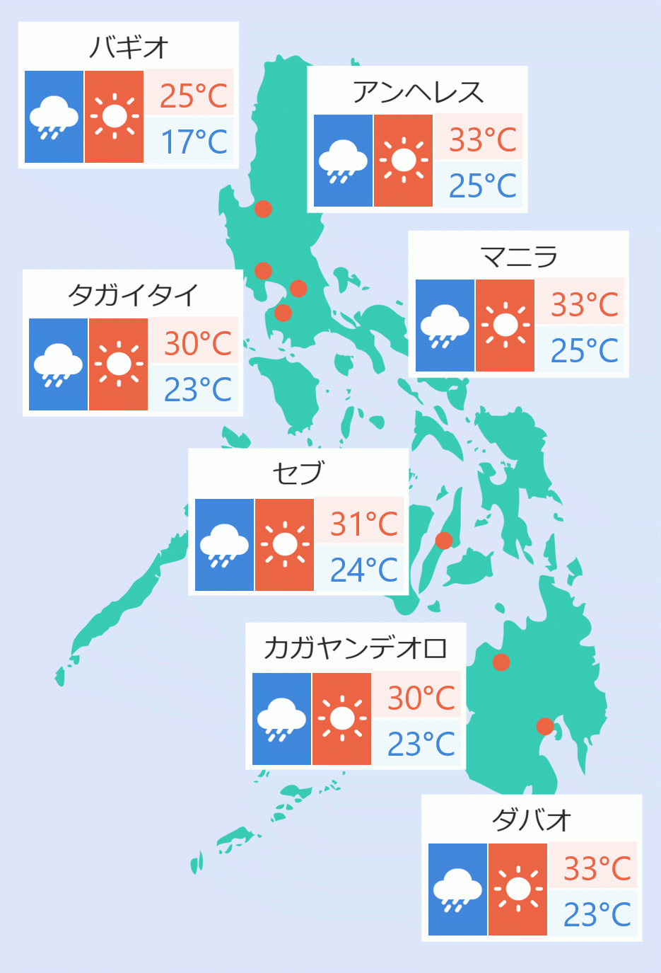
Pagasa said Jolina may bring moderate to heavy rains and at times intense rains over Northern Samar, Eastern Samar, and Sorsogon.
Moderate to heavy rains are expected over Bicol Region and the rest of Visayas in the next 24 hours.
"Jolina will track generally northwestward parallel to the east coast of the country until it makes landfall over the Northern-Central Luzon area by Thursday morning (09 September)," it stated.
"Jolina'' will move generally westward while traversing over the Northern- Central Luzon area and may re-emerge over the West Philippine Sea by Thursday evening.
It is forecast to exit the Philippine Area of Responsibility by Friday morning (10 September). Robina Asido/DMS