


 English
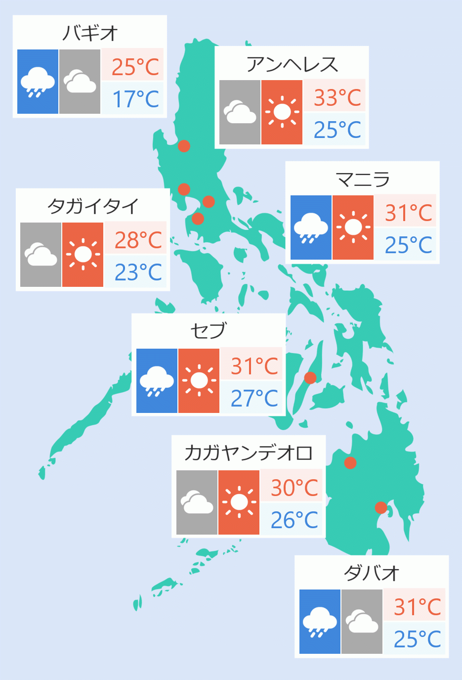
The low pressure area (LPA) at the eastern side of the country which developed into Tropical Depression on Wednesday is expected to intensify on Thursday morning, the state weather bureau said.
The LPA that was named Tropical Depression ''Crising'' was last spotted at 625 km east of Virac, Catanduanes as of 5pm on Wednesday.
''Crising'' is moving west southwest at the speed of 20 kph with maximum sustained winds of 45 kph near the center and gustiness of up to 55 kph.
According to the state weather bureau, "Crising is forecast to reach tropical sorm category tomorrow morning."
"It is forecast to continue intensifying over the Philippine Sea and may reach Severe Tropical Storm category on Friday afternoon or evening, before its approach to Northern Luzon. Further intensification up to Typhoon category prior to approach is also not ruled out," it stated.
''Crising'' is expected to "move generally westward over the next 12 hours before moving northwestward from tomorrow (July 17) afternoon until Friday (July 18) afternoon."
"It may pass close or make landfall over mainland Cagayan or Babuyan Islands from Friday evening to Saturday (July 19) early morning," it stated.
"Afterwards, it will move west northwestward and may exit the Philippine Area of Responsibility on Saturday afternoon or evening," it added. Robina Asido/DMS