


 English
Tropical Storm “Paeng” is expected to make landfall in the eastern coast of Aurora or Quezon on Sunday, the Philippine Atmospheric, Geophysical and Astronomical Services Administration (Pagasa) said Thursday.
According to its 5 pm bulletin, “Paeng” will move southwestward or west southwestward within six hours before turning generally west northwestward over the Philippine Sea through Sunday while moving towards central or southern portion of Luzon.
It was initially forecast to make landfall in the Cagayan and Isabela area.
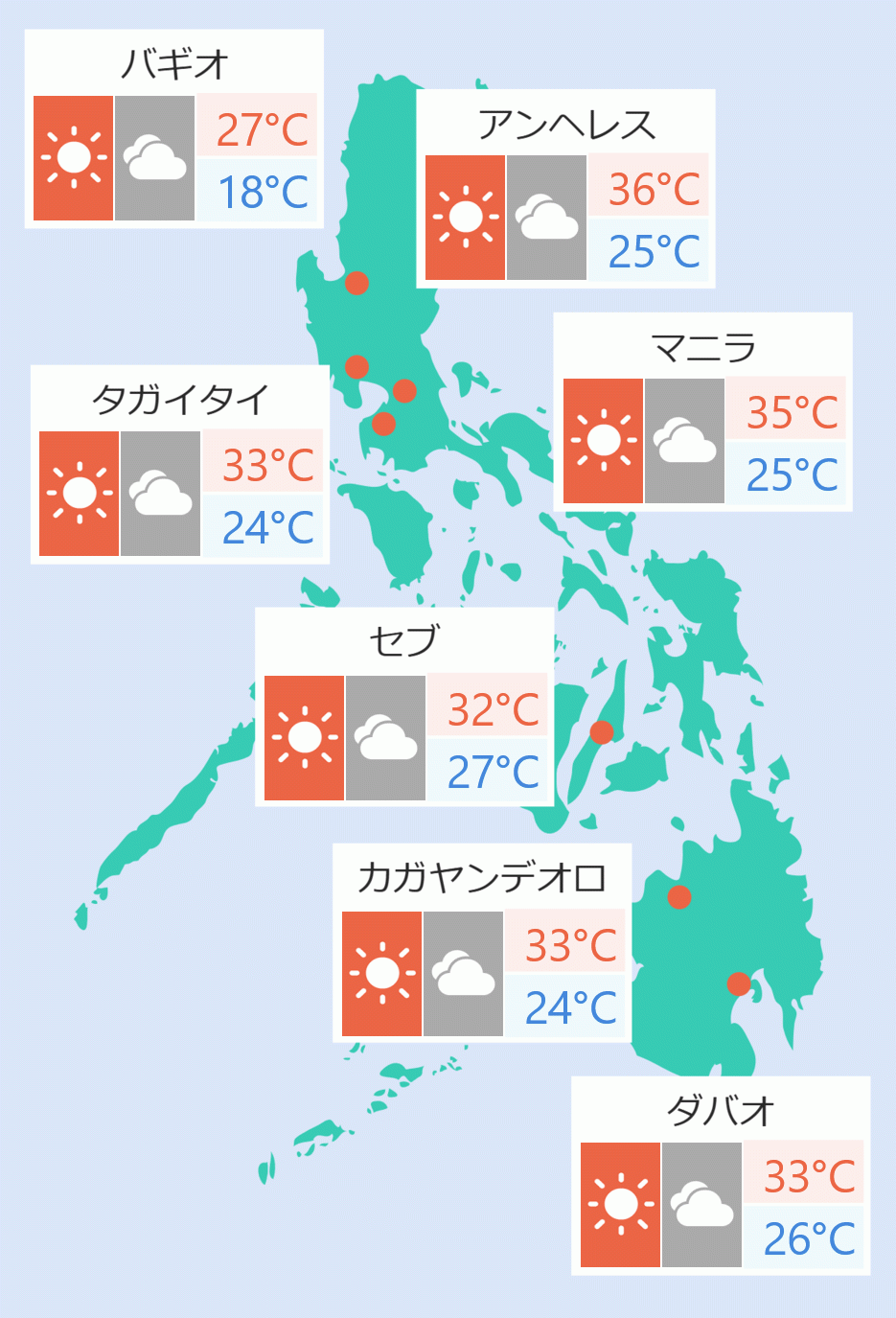
Pagasa said several areas, including Metro Manila, could experience moderate to heavy with at times intense rains.
“On the forecast track, Paeng may pass close to Catanduanes on Saturday and a landfall scenario is possible on Sunday in the eastern coast of Aurora or Quezon,” Pagasa said.
“Considering the southward shift in the forecast track, a possible landfall in the eastern portion of the Bicol Region is not ruled out at this time,” it added.
Moderate to at times intense rains are possible over the Bicol Region and Eastern Visayas from tomorrow early morning through evening, Pagasa said.
Areas under Tropical Cyclone Warning Signal Number were expanded. These are the eastern portion of Camarines Sur (Siruma, Tinambac, Goa, Lagonoy, Garchitorena, Caramoan, Presentacion, Saglay, San Jose, Tigaon, Ocampo, Iriga City, Buhi, Nabua, Bato, Balatan, Bula, Baao, Pili, Calabanga, Bombon, Magarao, Naga City, Milaor, Minalabac, San Fernando, Gainza, Camaligan, Canaman), Catanduanes, Albay, Sorsogon, and Masbate including Ticao Island and Burias Island.
Other areas under Tropical Cyclone Wind Signal Number one are Eastern Samar, Northern Samar, Samar, Biliran, and the northern portion of Leyte (San Isidro, Calubian, Tabango, Leyte, Capoocan, Carigara, Barugo, San Miguel, Babatngon, Tacloban City, Alangalang, Santa Fe, Palo).
The center of ''Paeng'' was last seen 510 km east of Borongan City, Eastern Samar with maximum winds of 65 km/h and gusts of up to 80 km/h.
“Paeng” is forecast to become a severe tropical storm within 24 hours and may turn into a typhoon by Saturday. Jaspearl Tan/ DMS